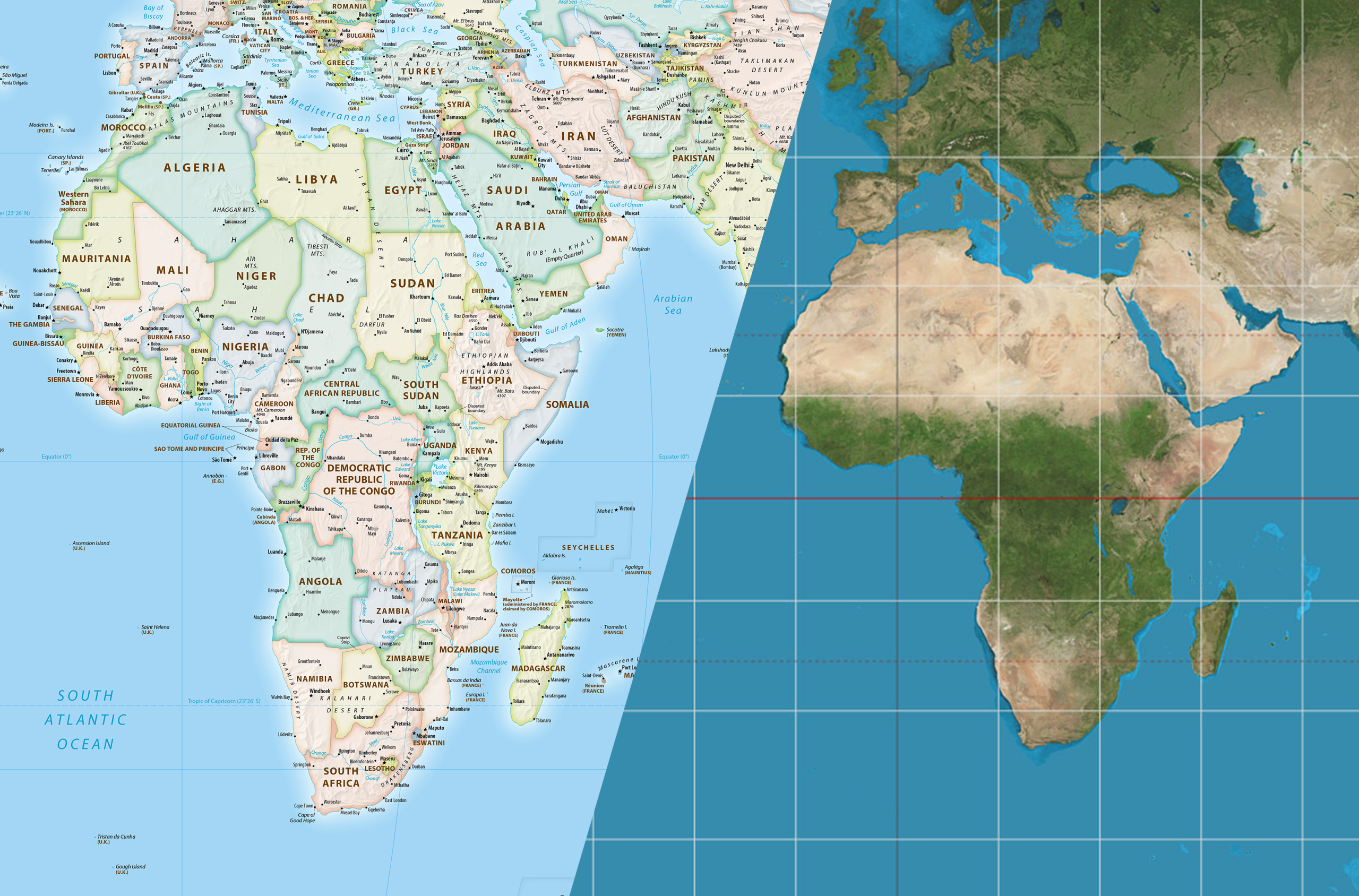
The UN General Assembly adopted a resolution put forward by Togo on behalf of the African Union calling for a gradual move away from the Mercator projection as the dominant representation of the world map and for the use of maps that more accurately reflect the true size of the continents.
A total of 164 countries voted in favour, six abstained and only the US voted against, calling the initiative unnecessary. The resolution is not binding and does not ban the use of the Mercator projection. However, it could influence school curricula, government bodies and digital mapping services, according to The Guardian.
Historians and geographers argue that the map is linked to systemic biases against countries in the Global South.
The Mercator projection was created in 1569 by Flemish cartographer Gerardus Mercator, primarily for navigation. Its advantage is that it preserves angles and directions, making navigation easier. The trade-off is significant distortion of land areas: the farther an area is from the Equator, the larger it appears. As a result, Greenland appears roughly the same size as Africa, even though Africa is about 14 times larger.
The resolution favours the Equal Earth projection, introduced in 2018, which represents the relative size of different regions more accurately. France has also announced that it will move away from Mercator in favour of Eckert IV, another equal-area projection.
The initiative is part of the African Union’s #CorrectTheMap campaign. Supporters argue that the traditional map visually understates the size of Africa and the Global South. Historians, geographers and activists have linked the Mercator projection to colonial and Eurocentric views and argue that this representation has contributed to systemic biases against the Global South in international trade and development priorities.
Source: The Guardian


 What is fyi.news?